Resources
We produce a wide variety of language resources for flood, storm and tsunami safety, communities at risk, school programs, home and business safety advice, interactive maps and plans.
Flood Data Access Portal
The NSW Flood Data Access Program is a joint partnership between the NSW State Emergency Service and the NSW Office of Environment and Heritage. The program aims to improve the sharing of key flood data within government and to other stakeholders, so that this information is more broadly available to be considered in decision making.
Click here to access the Flood Data Portal
Members Self Help
Need help accessing NSW SES systems? Click here for details on how to access the systems and resources
Local Plans and Guides
Look up your Location
Look up your Location to get the relevant plans for your area here: Your Local Risk
Once you have navigated to the right location, on the page click on the Local Plans and Guides Tab to find the various flood, storm and tsunami plans and guides.
or
Search by Region/Zone
Not sure what region boundary you fall under? Check the Statewide Map
Central West Region - Western Zone
Clarence Nambucca Region - Northern Zone
Far West Region - Western Zone
Illawarra South Coast Region - South East Zone
Lachlan Region - Southern Zone
Macquarie Region - Western Zone
Mid North Coast Region - Northern Zone
Murrumbidgee Region - Southern Zone
North West Region - Western Zone
Northern Rivers Region - Northern Zone
Southern Highlands Region - South East Zone
Northern Sydney Region - Metro Zone
Emergency Kit

We recommend that you and your family have an Emergency Kit made and ready to go, in case of evacuation, isolation or inundation.
Click here for more information on how you can create your own emergency kit
Create an Emergency Plan
In Australia, natural disasters such as floods, storm and even tsunami can strike without warning.
During an emergency, your main aim is to ensure your Home and Business is prepared for flood, storms and tsunami.
By carefully researching and planning before an emergency happens, you’ll be ready to act quickly and effectively.
Hawkesbury-Nepean FloodSafe
The Hawkesbury-Nepean River is one of the major river systems of NSW, draining a catchment area of 22,000 square kilometres. Exceptionally heavy rainfall in this area can lead to severe flooding.
This is worsened below Richmond by the fact that water flows into the valley much faster than it can flow out.
In the largest flood of record, which occurred in June 1867 flood waters reached approximately 12 metres higher than the deck of the present-day Windsor Bridge. Even larger floods than the 1867 are possible. Maps of the areas inundated in the 1867 flood are available for download.
Hawkesbury-Nepean River Flood Risk Management Planning Guides
Story Maps
The NSW State Emergency Service (NSW SES) utilises interactive mapping tools such Story Maps as to effectively retell historic jurisdictional events as well as communicate Flood, Storm and Tsunami risk.
Tsunami Evacuation Map
The NSW State Emergency Service (NSW SES) has released new maps showing evacuation areas in the event of a land-threat tsunami.
While the likelihood of a land-threat tsunami on the east coast of Australia is low, the maps show the areas where residents and workers would have to move to higher ground in the event of a land-threat tsunami.
Marine-threat tsunamis occur once about every six years, but are usually only dangerous to swimmers and boaters because of the dangerous currents. There is no record of a land-threat tsunami in Australia since European settlement.
If there is a threat of land inundation from a tsunami, move to higher ground, at least ten meters above sea level or one kilometer away from the coast and rivers. Be sure to listen to your local radio station for information, warnings and advice.
Click here for more information about tsunami
School Programs
The NSW SES is committed to building resilience to floods, storms and tsunami in NSW communities.
In Your Language
For all of our language resources available check out our In Your Language page.
Deaf and hearing impaired
Mobility impaired
Intellectual impairment
Vision impairment
Community Events
Staying connected and having insightful conversations in your community is a great way to plan and prepare for emergencies.
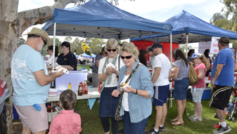
Attend local SES community events and chat to people who can help you and your family become more resilient in storm, flood and tsunami events. If you notice a local event in your area, come say hello - start a conversation that could help you and your community be better protected. Community Events
Get Ready with Tim and Tracy
With the start of storm season, watch couple Tim and Tracy work together to encourage NSW communities to Get Ready.
RSS Feed
RSS feeds allow you to receive updates from the NSW State Emergency Service (NSW SES), including summaries and web content with links to the full article on the NSW RFS website.
RSS feed information should be used in conjunction with primary communication sources, such as radio and tv reports, and common sense when evaluating your personal safety.
For current information about flood, storm and tsunami safety and Evacuation Orders please check the NSW SES website regularly at www.ses.nsw.gov.au
Community Events Feed
https://www.ses.nsw.gov.au/rss/getevents
Latest News Feed
https://www.ses.nsw.gov.au/rss/getnews
Community Notifications Feed
https://www.ses.nsw.gov.au/rss/getnotifications
Disclaimer
While care is taken to ensure accuracy, the NSW State Emergency Service cannot guarantee that information contained in RSS feeds is correct and recommends that users exercise their own skill and care with respect to its use.
Although every care is taken to ensure that all information in the NSW SES website is accurate and up to date, NSW SES cannot accept any responsibility for mistakes or omissions. Evacuation Orders, Warnings and All Clear update times may differ from the update time of incident details. The location of mapped incidents may be placed in the centre of the NSW SES Regional Boundaries.
We reserve the right to prevent the distribution of NSW State Emergency Service content.
Learn more about NSW SES About Us


